
After a week doing fieldwork in the villages south of Fuego, my friend Beth and I discussed the importance of reflecting on our work. Beth suggested that as well as evaluating our research approaches, it would be important to write about what it feels like to be there. I thought this was a splendid idea. Here’s my take on two communities we work in.
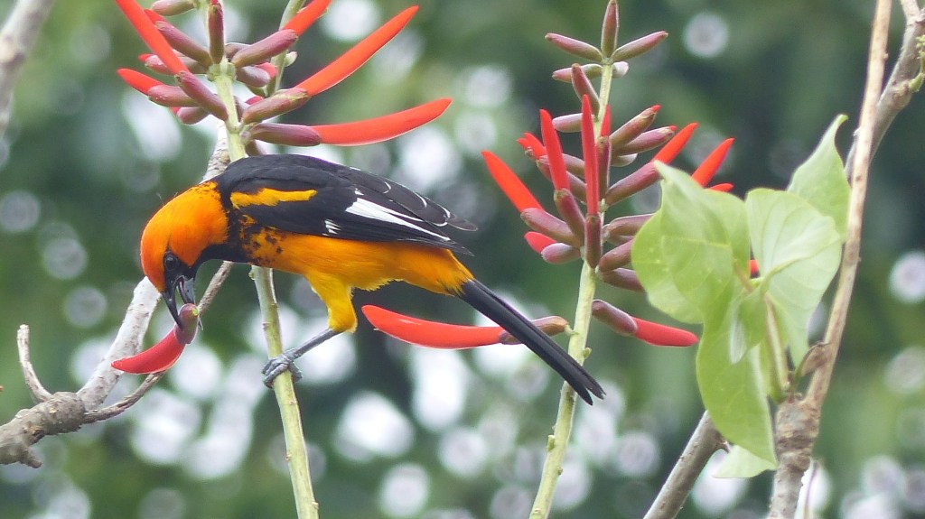
Panimaché Uno is a gorgeous, blooming village. It seems improbable that so much vitality can come from a soil so poor, but so it is. The earth is umber grit, and you imagine it would rasp against your teeth like coffee grounds from a bitter cup. Yet these bitter grounds host the sweetest and most extravagant plants. Brilliant bougainvillea; zebra-striped crotons with vermillion veins; the orange lipsticks of the arból de pito, where the colourful orioles eat. The buildings blossom out of the ground, too. There’s an inordinate number of churches for such a small village – 450 people, 105 families – and you can pick them out as you drive up its single road: the cheerful yellow-and-red Catholic church; the gleaming turquoise Evangelical house, opposite the school. On a wall of the school is the muddied and dull mural of 13 September 2012 eruption. Perhaps this difference in repair is appropriate: the volcano is only occasionally bothersome, yet God is invoked in many occasions, everyday. And yet we hear many locals tell us that, “el único es el volcán”.
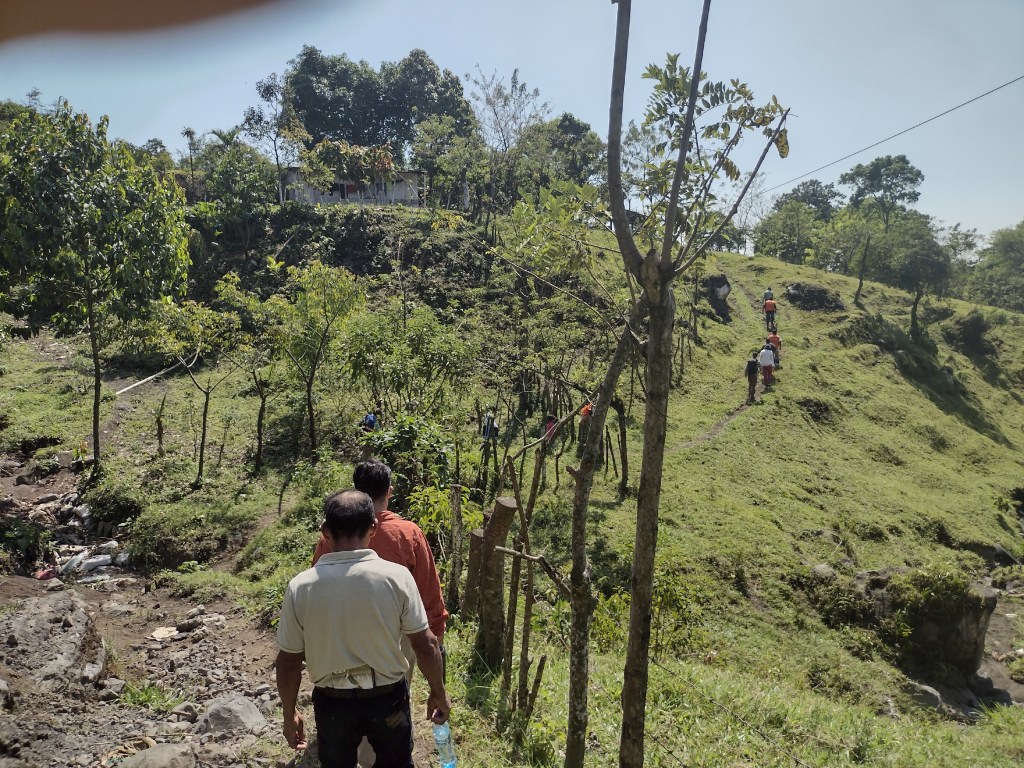
I remember that only a few years ago the adoquín paving reached only halfway through Panimaché Uno, and the remaining road to the observatory at the top of the village included a cement manhole that stood fearsome and proud in the middle of the dirt track. Now the adoquín goes all the way up. The smoothness enhances the sense of slope, so that if you walk to the observatory you can really sense you are climbing towards the mouth of a volcano. As I walk, I pass a group of kids playing ball, then a man descending with machete at his hip, hauling a stack of hoja de mazán on his forehead. This handsome leaf, used for wrapping tamales, grows in abundance in the forest above the village, as do the avocados in the nearby finca called San Francisco Panimaché. So: the land bears fruit. But within the village Panimaché I see only a few small stands of spindly coffee trees. It’s probably a question of scale: I imagine the finca owners can afford lots of compost, and delegate parcels of land to allow some patches time to regenerate. The small stakeholders don’t have that luxury.
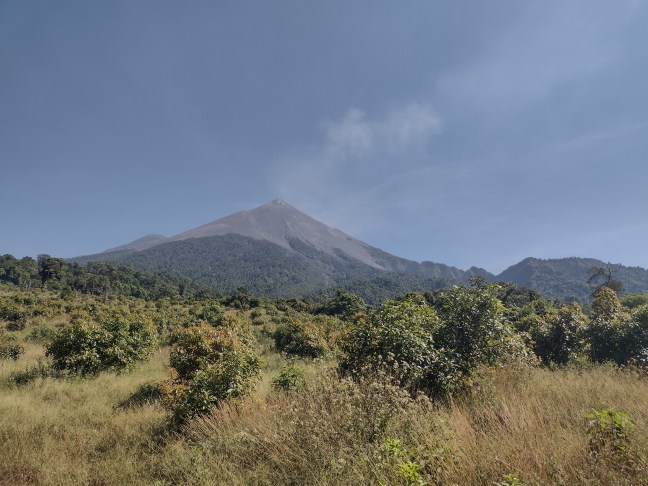
The view from the observatory roof is incredible: Fuego looms large above the village. The only fly in the ointment is a nearby streetlight, whose flame diminishes Fuego’s. But a tree is growing in front of the light, and will soon cover up its blare. Far below, there is the town of Morelia; beyond that is a river; and beyond that, the outside world. But here is peaceful paradise.


Panimaché Dos: instead of fresh adoquín, the structure that greets you at the entrance to the second Panimaché is a low wall, covered with moss. One aldea speaks of development and growth, the other of loss and ruin. And yet, the Aldea Formerly Known As Panimaché Uno has a particular and curious charm. It could be the improbability that people should keep living here, somewhere so remote and so badly scourged by Fuego. Once I went behind a house in the bottom of the village to see how the family there were digging a plumbing system into three different layers of arena. Red, brown, black; rugged and angular, defiant to the effects of over 50 years’ rainy seasons: this earth is not for sowing. Why should people persist here? And yet they do, and seem happy.
This Panimaché also has an abundance of churches, although I can’t find them all. Unlike the open hand that is Panimaché Uno, which rises west of Barranca Taniluyá like a lily on a pond, Panimaché Dos is curled in tightly like a secret. Consider: the twin peaks of Atitlán and Tolimán, visible only in the fields above; the two ovens in those fields, one rotting between milpa and mandarinos; the third oven that completes the trilogy, happily mossing over in someone’s backyard; the papaya tree in another garden, revealed to be a yardstick of arena fall in the 1967 eruption; and Fuego itself, only six kilometres away but seen mostly at night or glimpsed in snatches between trees. During one visit to this village, I was ushered into a room for an interview, and inside was a whole soundsystem and a drumkit, and it turned out that the younger villagers tour towns far and wide in Guatemala to perform. This is probably why I like Panimaché Dos so much. I love stories, and I love secrets, and this aldea has many of both, remarkable in one so small. On the other hand, when we talk to villagers they describe themselves as encerrado, olvidada, dejados atrás (closed in, forgotten, left behind). Are these secrets? Or are they plain truths that are familiar in the village, and only surprising to an outsider because so few of us visit? These aldeas cannot be forgotten. Who knew about San Miguel Los Lotes before 2018?
The closest hill to Panimaché Dos is called “El Desengaño” (the disenchanted), and that is where one is supposed to go when evacuating from a large eruption of Fuego. Perhaps you can also arrive when tired of the secrets of Panimaché Dos, or when you have broken free of its spell.


Well written. You had me wondering, for a moment, what it might be like to live there. I wonder if I can find these places on a map…but no, this is too close to a volcano.
LikeLike