
I’ve been longing to write about last Thursday on the side of Tungurahua, and a completed post has been long in the works. However, since my last post (here), I have climbed Tungurahua, risked a rickety bus journey to the city, celebrated the capital’s birthday at Fiesta de Quito, worked on the side of Cotopaxi, been kicked out of an apartment and reinstated, and finished some PhD applications. Things have definitely been frantic, but still: I apologise for the late response.
The Thursday in question, 3rd December, was fascinating because I learned first-hand the devastating power that a volcano can have, even with minor eruptions. During the course of our 14-hour day, we saw damage to property and to people, and I understood some of the danger and damage that is faced by those who choose to live on and reap the benefits of the volcano’s fertile flanks.
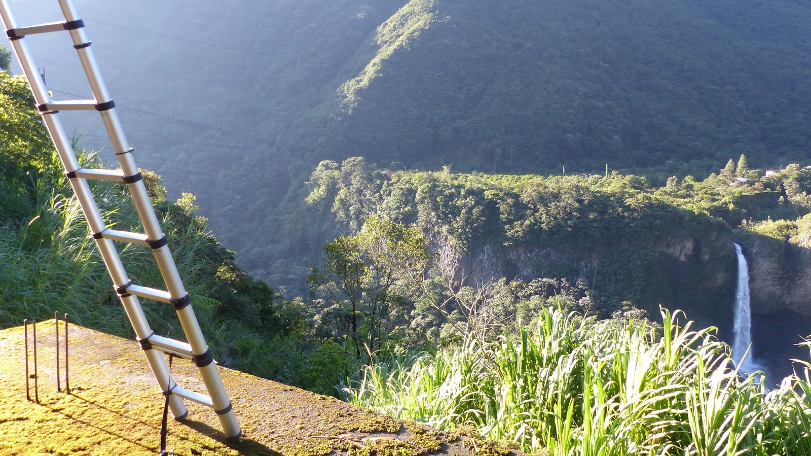
I was out for the day with Ben, a long-time expert in Tungurahua ash. We began our day at 06:30, and by eight had already invaded houses, climbed the side of a castle, and infiltrated the roof of a school. The reason? To inspect Ben’s cenizometros, ingenious contraptions made from plastic bottles that were designed to capture and quantify the amount of ash that had fallen from the volcano. Of course, ash first falls on roofs and terraces, and so the cenizometros (ceniza = ash in Spanish) had to be both vulnerable to open air and well-hidden from inquisitive strangers. My favourite cenizometro spot was below, at Rio Verde overlooking the Manto de la Novia (Bride’s Veil) waterfall. We could see the volcano to our south, beautiful and distant, slightly hazy. As the day grew, it became clearer and clearer – the damage that it could do.
 |
| Real-life Chutes and Ladders. |
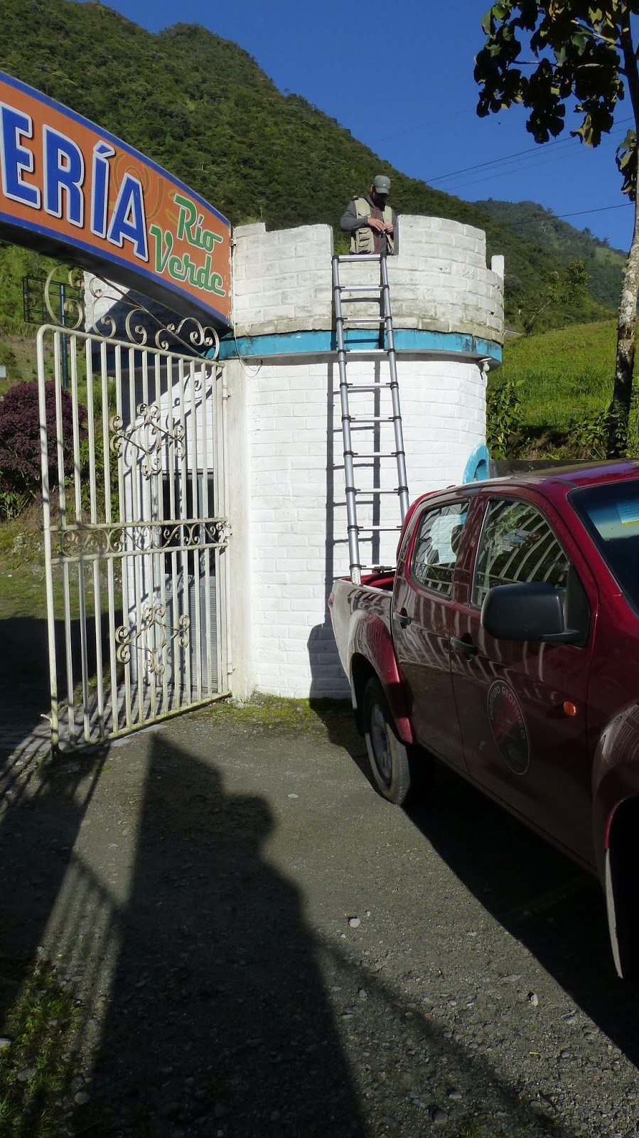 |
| And they say that academics live in an ivory tower … |
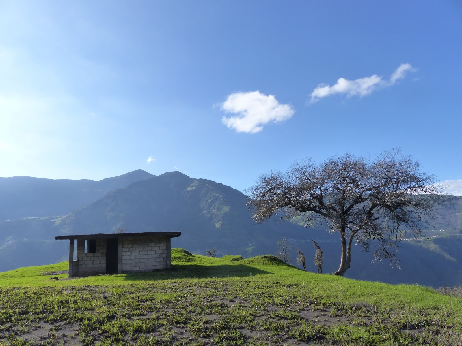
After we had completed our studies of the villages to the east, we took the eastern road towards Riobamba. We stopped above the small town of Bilbao, and here began a long trek up the side of the volcano. Little by little, the lush beauty of the valley left us behind. The flowers were the first to go, their riot of colour changed up to a simple palette of two: green, the grass; grey, the ash. The trees were uniformly silver, their leaves shivering in fear at lower altitudes, and abducted further up. Trees became limbs became stumps wizened to nothing, ground down in the receding grass. Eventually, that went too.
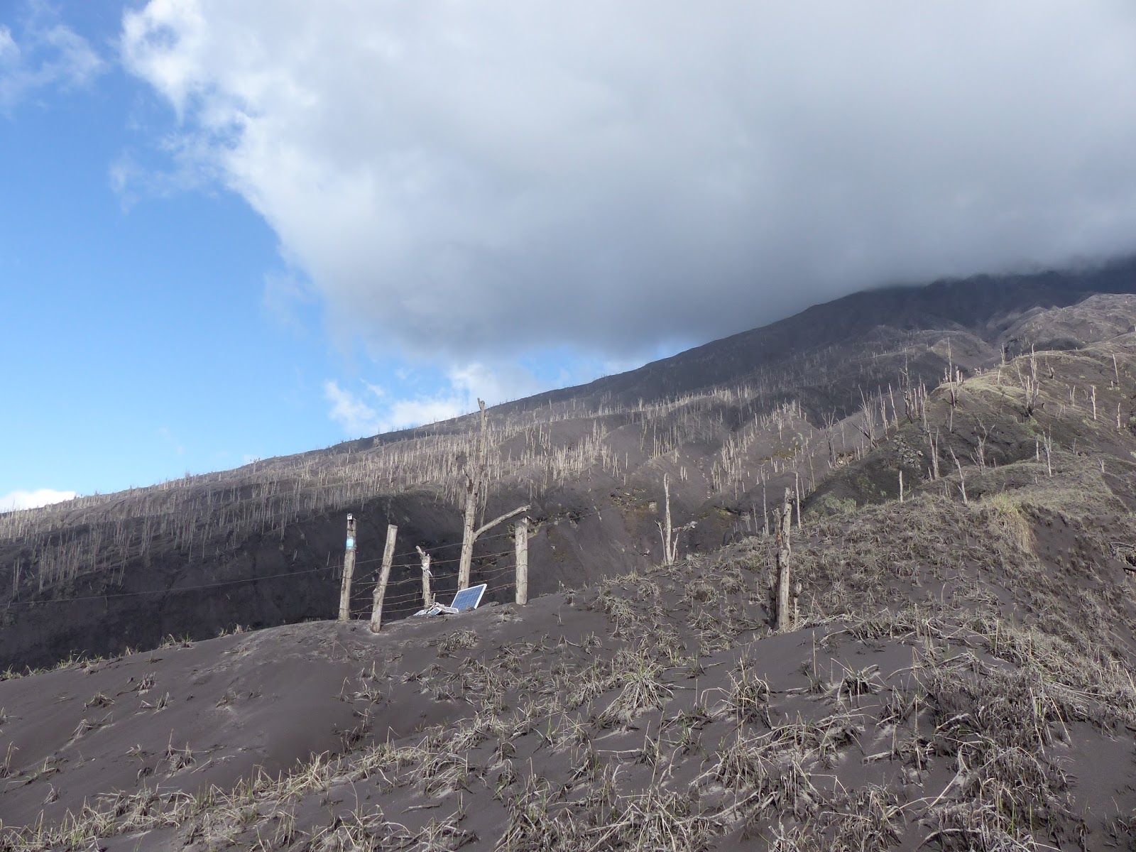 |
| The dead and dying life around T-07, the highest station on the western flank of Tungurahua. |
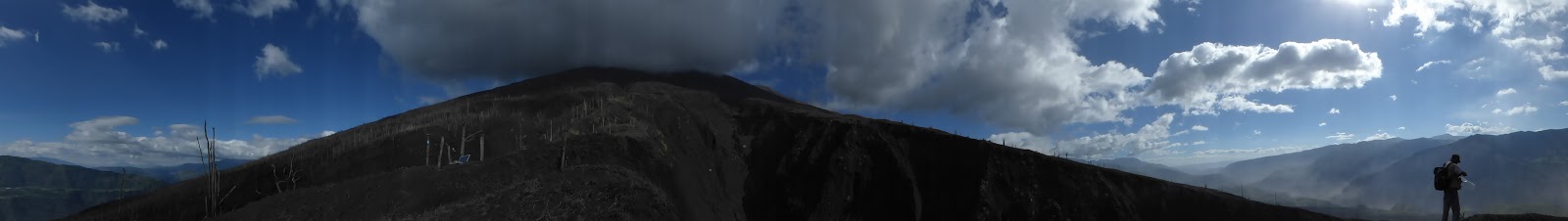 |
| A barren landscape at 3000 metres. |
 |
| One of the many houses abandoned to ruin by previous volcanic activity. The tree to the left stood perfectly silver with ash. |
 |
| Below the ruined houses, you can see the remains of the former bridge at Palilactua. The houses have indoor gardens, now. |
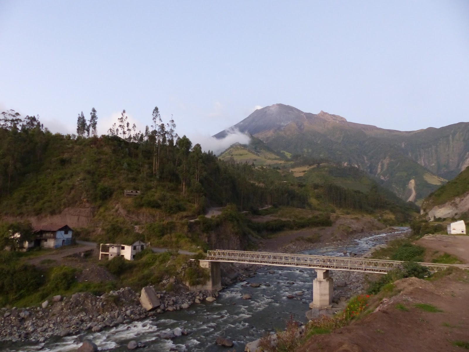
Our penultimate stop was at Palilactua, in which we arrived just as dusk was falling (19:15). The volcano was usually never clear from this side, but it appeared that we had struck lucky. By the falling light, I could look out from the cenizometro spot and see the ruins, the aftermath of a huge lahar that had passed through the village in 2010. On the left bank of the river, a concrete slab from the previous bridge provided a convenient headstone to itself. Ruined houses mournfully tended gardens within their cloistered walls. A man passed us, his eyes suspicious and watchful.
By the time we finished, it was so dark that we were working in head-torches. Our final cenizometro stop was beside a pig-pen in the high village near Huambalo. I listened to the pigs snort, and counted the stars, while holding a conversation with the owner of the pigs. He told us of the eruption on 18th November. Wild storms! Darkness at midday! We asked if he had been affected, but it seemed not. It’s never fair, whom the volcano hurts.

A memorable and very personal account of the precariousness of life on the edge of an active volcano. I can picture so many of the scenes you describe, Ailsa.
LikeLike